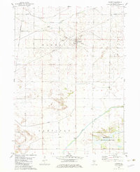
1982 Map of Harmon
USGS Topo · Published 1982About this map
The village of Harmon serves as the central hub of this agricultural landscape in Lee County, where the transition between the townships of Harmon and Hamilton is defined by a dense grid of rural roads and drainage channels. The Burlington Northern railroad bisects the settlement, reflecting the rail-centered development of the Illinois prairie. To the south, the terrain shifts towards the Green River bottomlands, anchored by the Green River State Wildlife Management Area. Local history is preserved at sites like Holy Cross Cem and Centenary Cem, while smaller place names such as Van Petten and Foy mark the locations of former rail stops or rural crossroads. The map also captures several major infrastructure elements, including the Chicago and North Western line in the west and several pipelines traversing the farmland.
Find a feature on this map
43 named features on this map. Tap any name to fly to it.
Don’t see what you’re looking for? This feature index may not catch every label — zoom into the map to look around manually.
Map Details
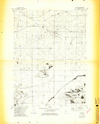
Editions of this 1982 Harmon Map
3 editions found
Other maps of this area

1918 · Dixon
USGS Topo · 1:62,500

1930 · Woodsung
USGS Topo · 1:48,000

1946 · Sterling
USGS Topo · 1:62,500

1948 · Sterling
USGS Topo · 1:62,500

1949 · Walnut
USGS Topo · 1:62,500

1950 · Dixon
USGS Topo · 1:62,500

1951 · Amboy
USGS Topo · 1:62,500

1958 · Aurora
USGS Topo · 1:250,000

1961 · Aurora
USGS Topo · 1:250,000

1982 · Harmon
USGS Topo · 1:24,000