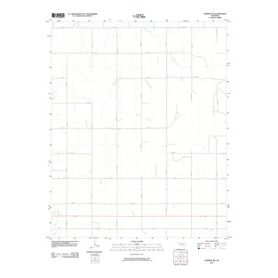
2010 Map of Harmon NW
USGS Topo · Published 2010About this map
Buzzard Creek and its subtle drainage network define this section of the High Plains in western Oklahoma, where the landscape is organized by an exacting section-line road grid. The map reveals a highly structured rural environment dominated by long-distance county roads like E 0530 Rd and N 1860 Rd. This intersection of topography and geometry illustrates the late 20th-century agricultural footprint, where nearly every square mile is accessible by a planned thoroughfare. The drainage patterns of Little Wolf Creek in the northwest and Mosquito Creek in the southwest break the rigid grid, indicating the natural draws that once guided early settlement and cattle movement before the modernization of the road network.
Find a feature on this map
19 named features on this map. Tap any name to fly to it.
Don’t see what you’re looking for? This feature index may not catch every label — zoom into the map to look around manually.
Map Details
Editions of this 2010 Harmon NW Map
This is the sole edition of this map. No revisions or reprints were ever made.
Other maps of this area

1955 · Woodward
USGS Topo · 1:250,000

1958 · Woodward
USGS Topo · 1:250,000

1969 · Fargo SW
USGS Topo · 1:24,000

1969 · Gage
USGS Topo · 1:24,000

1969 · Fargo SE
USGS Topo · 1:24,000

1970 · Arnett
USGS Topo · 1:24,000

1970 · Harmon
USGS Topo · 1:24,000

1970 · Arnett SE
USGS Topo · 1:24,000

1970 · Harmon SW
USGS Topo · 1:24,000
1970 · Harmon SE
USGS Topo · 1:24,000