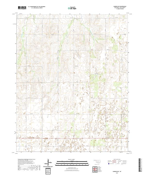
2022 Map of Harmon NW
USGS Topo · Published 2022About this map
Little Wolf Cr and Buzzard Cr drain this expansive prairie landscape in western Oklahoma, where the land is strictly organized by the Public Land Survey System. The map reveals a highly regularized network of section line roads, such as n1860 RD and e0550 RD, which facilitate movement through a region dominated by agricultural ranching and petroleum extraction. A specific Oil Field Rd in the central portion of the survey indicates the localized industrial presence amidst the rolling drainage basins. This area, spanning several townships including t20n r23w and t21n r24w, reflects the enduring spatial patterns of the High Plains, where seasonal waterways like Mosquito Cr provide the primary topographic relief against the grid of section boundaries.
Find a feature on this map
29 named features on this map. Tap any name to fly to it.
Don’t see what you’re looking for? This feature index may not catch every label — zoom into the map to look around manually.
Map Details
Editions of this 2022 Harmon NW Map
This is the sole edition of this map. No revisions or reprints were ever made.
Other maps of this area

1955 · Woodward
USGS Topo · 1:250,000

1958 · Woodward
USGS Topo · 1:250,000

1969 · Fargo SW
USGS Topo · 1:24,000

1969 · Gage
USGS Topo · 1:24,000

1969 · Fargo SE
USGS Topo · 1:24,000

1970 · Arnett
USGS Topo · 1:24,000

1970 · Harmon
USGS Topo · 1:24,000

1970 · Arnett SE
USGS Topo · 1:24,000

1970 · Harmon SW
USGS Topo · 1:24,000
1970 · Harmon SE
USGS Topo · 1:24,000