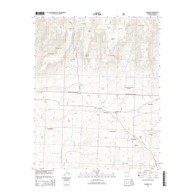
2014 Map of Harmony
USGS Topo · Published 2014About this map
Harmony sits at the heart of this landscape, flanked by a dense network of family and community cemeteries that speak to the deep-rooted settlement history of Johnson County. The topography is defined by the Ozark National Forest and the ridgelines of Chinquapin Ridge and McConnell Ridge, where numerous creek branches like E Fork Horsehead Cr and Little Spadra Cr carve through the terrain. The presence of the Linville Gas Field and Clarksville Gas Field indicates the subsurface energy economy that exists alongside rural homesteads and agricultural plots.
Find a feature on this map
61 named features on this map. Tap any name to fly to it.
Don’t see what you’re looking for? This feature index may not catch every label — zoom into the map to look around manually.
Map Details
Editions of this 2014 Harmony Map
This is the sole edition of this map. No revisions or reprints were ever made.
Other maps of this area

1887 · Magazine Mountain #1
USGS Topo · 1:62,500

1887 · Magazine Mountain
USGS Topo · 1:62,500

1888 · Dardanelle #2
USGS Topo · 1:62,500

1889 · Ozone
USGS Topo · 1:62,500

1890 · Magazine Mountain
USGS Topo · 1:125,000

1890 · Dardanelle
USGS Topo · 1:125,000

1906 · Batson
USGS Topo · 1:62,500

1934 · Ozone
USGS Topo · 1:62,500

1936 · Ozone
USGS Topo · 1:62,500

1956 · Russellville
USGS Topo · 1:250,000