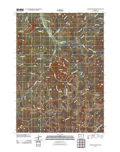
2011 Map of Harness Mountain
USGS Topo · Published 2011About this map
The Coast Fork Willamette River winds through the northern reaches of this landscape, crossed by the Rouse Bridge near the Bemis Cemetery. This 2011 survey reveals a rugged interior dominated by timber management and significant elevations, including Harness Mountain and Cinnabar Mountain. The network of Bureau of Land Management roads, such as the London Weyerhaeuser Rd and Cougar Bend Rd, traces the drainage divides between the Big River and Little River. Several distinctive peaks, including Black Butte, Stennett Butte, and Big Baldy, highlight the complex topography south of the London Rd corridor. This map is an essential reference for understanding the modern footprint of the upper Willamette watershed's working forest and its scattered landmarks.
Find a feature on this map
47 named features on this map. Tap any name to fly to it.
Don’t see what you’re looking for? This feature index may not catch every label — zoom into the map to look around manually.
Map Details
Editions of this 2011 Harness Mountain Map
This is the sole edition of this map. No revisions or reprints were ever made.
Other maps of this area

1897 · Roseburg
USGS Topo · 1:125,000

1900 · Roseburg
USGS Topo · 1:125,000

1935 · Lowell
USGS Topo · 1:96,000

1942 · Lowell
USGS Topo · 1:125,000

1954 · Anlauf
USGS Topo · 1:62,500

1954 · Glide
USGS Topo · 1:62,500

1955 · Mace Mtn
USGS Topo · 1:62,500

1955 · Culp Creek
USGS Topo · 1:62,500

1958 · Roseburg
USGS Topo · 1:250,000

1959 · Roseburg
USGS Topo · 1:250,000