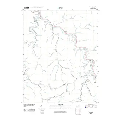
2010 Map of Harold
USGS Topo · Published 2010About this map
Levisa Fork and Beaver Creek dominate the landscape of this eastern Kentucky region, where valley floors dictate the layout of transportation and community life. The convergence of these waters at Beaver Junction near Allen City creates a hub of settlement, with the rail corridor along C and O Rd linking a string of coal-country towns including Ivel, Tram, and Stanville. The map illustrates the persistent pattern of ridge-and-hollow development, where homes and roads like Banner Rd and Daniels Creek Rd are tucked tightly into narrow drainage basins.
Find a feature on this map
91 named features on this map. Tap any name to fly to it.
Don’t see what you’re looking for? This feature index may not catch every label — zoom into the map to look around manually.
Map Details
Editions of this 2010 Harold Map
This is the sole edition of this map. No revisions or reprints were ever made.
Other maps of this area

1886 · Prestonsburg
USGS Topo · 1:125,000

1890 · Whitesburg
USGS Topo · 1:125,000

1892 · Whitesburg
USGS Topo · 1:125,000

1892 · Prestonsburg
USGS Topo · 1:125,000

1912 · Hindman
USGS Topo · 1:48,000

1914 · Laynesville
USGS Topo · 1:48,000

1914 · Vergie
USGS Topo · 1:48,000

1915 · Prestonsburg
USGS Topo · 1:62,500

1915 · Hindman
USGS Topo · 1:62,500

1916 · Harold
USGS Topo · 1:62,500