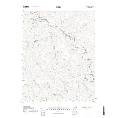
2019 Map of Harold
USGS Topo · Published 2019About this map
Levisa Fork winds through the heart of this Floyd County landscape, serving as the primary corridor for a string of Appalachian communities. In the late 2010s, this area reflects a dense pattern of valley-floor settlement, where towns like Harold and Betsy Layne are joined by many smaller named locales such as Banner, Ivel, and Tram. The winding path of Beaver Creek meets the main river at Beaver Junction, a point historically significant for regional transit and industrial connectivity. To the south, the terrain becomes increasingly complex, with settlements like Honaker and the uniquely named Blue Moon located along the narrow hollows. The presence of the Davidson Memorial Gardens Cem and numerous named branches—such as Arkansas Cr and Prater Cr—provides a high level of detail for local historians tracing family lands and the geographic evolution of the Big Sandy River basin.
Find a feature on this map
127 named features on this map. Tap any name to fly to it.
Don’t see what you’re looking for? This feature index may not catch every label — zoom into the map to look around manually.
Map Details
Editions of this 2019 Harold Map
This is the sole edition of this map. No revisions or reprints were ever made.
Other maps of this area

1886 · Prestonsburg
USGS Topo · 1:125,000

1890 · Whitesburg
USGS Topo · 1:125,000

1892 · Whitesburg
USGS Topo · 1:125,000

1892 · Prestonsburg
USGS Topo · 1:125,000

1912 · Hindman
USGS Topo · 1:48,000

1914 · Laynesville
USGS Topo · 1:48,000

1914 · Vergie
USGS Topo · 1:48,000

1915 · Prestonsburg
USGS Topo · 1:62,500

1915 · Hindman
USGS Topo · 1:62,500

1916 · Harold
USGS Topo · 1:62,500