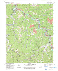
1992 Map of Harold
USGS Topo · Published 1992About this map
Levisa Fork winds through the heart of this Floyd County landscape, serving as the primary corridor for both the CSX railroad and local commerce in the early 1990s. The settlement pattern follows the narrow valley floors, with concentrated communities like Betsy Layne, Harold, and Ivel positioned between the steep hillsides and the river's edge. This era shows a region deeply defined by extractive industry, evidenced by numerous labeled Strip Mines, Mine Dumps, and Tipples that mark the terrain. Educational and civic anchors are well-established, including the Betsy Layne High Sch and Mayo Voc-Tech Sch. Smaller communities such as Dwale, Banner, and Printer are connected by the winding routes of KY 1428 and KY 122, while more remote reaches like Blue Moon and Trace occupy the deep hollows of the southern quadrangle near Mud Creek.
Find a feature on this map
64 named features on this map. Tap any name to fly to it.
Don’t see what you’re looking for? This feature index may not catch every label — zoom into the map to look around manually.
Map Details
Editions of this 1992 Harold Map
This is the sole edition of this map. No revisions or reprints were ever made.
Other maps of this area

1886 · Prestonsburg
USGS Topo · 1:125,000

1890 · Whitesburg
USGS Topo · 1:125,000

1892 · Whitesburg
USGS Topo · 1:125,000

1892 · Prestonsburg
USGS Topo · 1:125,000

1912 · Hindman
USGS Topo · 1:48,000

1914 · Laynesville
USGS Topo · 1:48,000

1914 · Vergie
USGS Topo · 1:48,000

1915 · Prestonsburg
USGS Topo · 1:62,500

1915 · Hindman
USGS Topo · 1:62,500

1916 · Harold
USGS Topo · 1:62,500