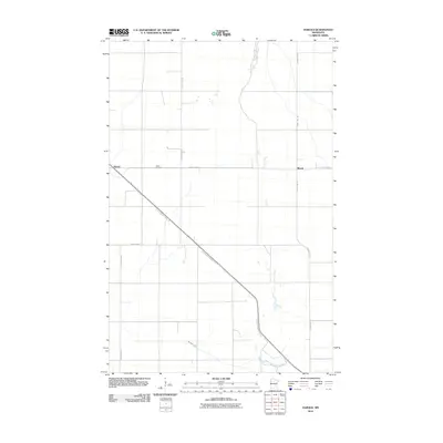
2010 Map of Harold
USGS Topo · Published 2010About this map
Harold and Benoit anchor this Polk County landscape, which is defined by a rigid grid of rural roads and the diagonal path of the Agassiz Recreational Trl. The territory is predominantly agricultural, with Burnham Creek meandering across the southern portion of the quadrangle. For genealogists and local historians, the Hafslo Cemetery serves as a significant landmark along County Hwy-45, reflecting the area's early settlement history. The infrastructure is characterized by long, straight thoroughfares like County Hwy-44 and County Hwy-48, which facilitate the movement of goods and people across the flat Red River Valley terrain. This 2010 survey illustrates the persistence of small rural communities and the conversion of old rail corridors into modern recreational paths.
Find a feature on this map
9 named features on this map. Tap any name to fly to it.
Don’t see what you’re looking for? This feature index may not catch every label — zoom into the map to look around manually.
Map Details
Editions of this 2010 Harold Map
This is the sole edition of this map. No revisions or reprints were ever made.
Other maps of this area

1918 · Red Lake Falls
USGS Topo · 1:62,500

1919 · Beltrami
USGS Topo · 1:62,500

1952 · Red Lake Falls
USGS Topo · 1:62,500

1952 · Grand Forks
USGS Topo · 1:250,000

1953 · Crookston
USGS Topo · 1:62,500

1956 · Grand Forks
USGS Topo · 1:250,000

1964 · Beltrami
USGS Topo · 1:24,000

1964 · Greenview
USGS Topo · 1:24,000

1965 · Dugdale
USGS Topo · 1:24,000

1965 · Fertile
USGS Topo · 1:24,000