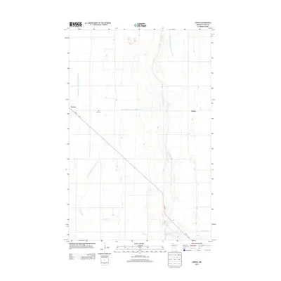
2013 Map of Harold
USGS Topo · Published 2013About this map
Harold and Benoit anchor this Polk County landscape, defined by an extensive network of water management projects essential to the region's agricultural productivity. The flat terrain of the Red River Valley is meticulously carved with numbered waterways, including County Ditch Number One Hundred Five and County Ditch Number One Hundred Forty, which channel water toward natural courses like Burnham Cr. This infrastructure reflects over a century of land reclamation efforts that transformed the prairie into stable farmland. For those researching local history or genealogy, the presence of Hafslo Cem near the intersection of MN-102 provides a specific point of interest, marking the enduring presence of the community's early settlers and their ties to this highly engineered landscape.
Find a feature on this map
9 named features on this map. Tap any name to fly to it.
Don’t see what you’re looking for? This feature index may not catch every label — zoom into the map to look around manually.
Map Details
Editions of this 2013 Harold Map
This is the sole edition of this map. No revisions or reprints were ever made.
Other maps of this area

1918 · Red Lake Falls
USGS Topo · 1:62,500

1919 · Beltrami
USGS Topo · 1:62,500

1952 · Red Lake Falls
USGS Topo · 1:62,500

1952 · Grand Forks
USGS Topo · 1:250,000

1953 · Crookston
USGS Topo · 1:62,500

1956 · Grand Forks
USGS Topo · 1:250,000

1964 · Beltrami
USGS Topo · 1:24,000

1964 · Greenview
USGS Topo · 1:24,000

1965 · Dugdale
USGS Topo · 1:24,000

1965 · Fertile
USGS Topo · 1:24,000