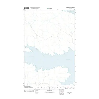
2011 Map of Harper Camp
USGS Topo · Published 2011About this map
Fort Peck Lake dominates the southern half of this landscape, its complex, finger-like shoreline defining the geography of the Missouri River country. The northern terrain is marked by the elevated expanse of Harper Ridge, which separates the drainages of Carpenter Creek to the north from the direct runoff into the reservoir. Near the eastern edge of the ridge sits Harper Camp, a small settlement node linked by a network of unimproved roads that navigate the coulees and high plains of Valley County. The interplay between the massive water body and the surrounding drainages, including Cabin Coulee, illustrates the topographic transition from the dry Montana uplands to the expansive artificial shoreline. This 2011 survey captures the rural infrastructure of the area, showing the sparse but critical transportation lines that serve the high country above the lake.
Find a feature on this map
5 named features on this map. Tap any name to fly to it.
Don’t see what you’re looking for? This feature index may not catch every label — zoom into the map to look around manually.
Map Details
Editions of this 2011 Harper Camp Map
This is the sole edition of this map. No revisions or reprints were ever made.
Other maps of this area

1954 · Jordan
USGS Topo · 1:250,000

1956 · Jordan
USGS Topo · 1:250,000

1958 · Jordan
USGS Topo · 1:250,000

1958 · Collins Ranch
USGS Topo · 1:62,500

1958 · Maloney Hill
USGS Topo · 1:62,500

1964 · Jordan
USGS Topo · 1:250,000

1971 · Hell Hollow
USGS Topo · 1:24,000

1971 · Trumbo Ranch
USGS Topo · 1:24,000

1971 · Wagon Coulee
USGS Topo · 1:24,000

1971 · Harper Camp
USGS Topo · 1:24,000