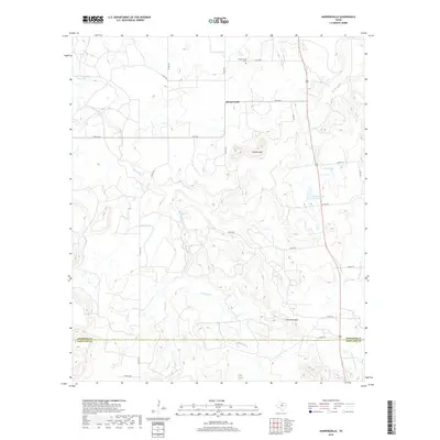
2019 Map of Harpersville
USGS Topo · Published 2019About this map
Harpersville stands at the center of this rural landscape where the northern boundary of Eastland County meets the southern edge of Stephens County. The terrain is defined by low ridges and complex drainage basins, most notably marked by the prominent height of Double Mtn and the topographical pass known as Limestone gap. Water management is central to the area's geography, evidenced by the Texas Company Reservoir and the H Graden Dye Reservoir, which catch the flow of intermittent streams like Big Sandy Cr and Live Oak Cr. The map provides a detailed view of the local road network, including numerous county roads and FM 1032, which link the small settlement to its surroundings. Genealogists will find the Harpersville Cem a significant landmark for tracing local family histories in this part of North Central Texas.
Find a feature on this map
32 named features on this map. Tap any name to fly to it.
Don’t see what you’re looking for? This feature index may not catch every label — zoom into the map to look around manually.
Map Details
Editions of this 2019 Harpersville Map
This is the sole edition of this map. No revisions or reprints were ever made.
Other maps of this area

1890 · Breckenridge
USGS Topo · 1:125,000

1892 · Albany
USGS Topo · 1:125,000

1893 · Albany
USGS Topo · 1:125,000

1894 · Eastland
USGS Topo · 1:125,000

1931 · Baird
USGS Topo · 1:125,000

1932 · Baird
USGS Topo · 1:125,000

1954 · Abilene
USGS Topo · 1:250,000

1958 · Abilene
USGS Topo · 1:250,000

1961 · Buck Mountain
USGS Topo · 1:24,000

1961 · Eolian
USGS Topo · 1:24,000