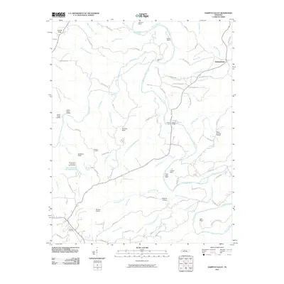
2010 Map of Harpeth Valley
USGS Topo · Published 2010About this map
The Harpeth River carves a winding path through this portion of Tennessee, creating dramatic landforms like Paint Rock Bluff and deep river bends such as Corlew Bend and Bells Bend. This 2010 landscape is characterized by its complex hydrology, where numerous tributaries like Little Leatherwood Creek and Jones Creek feed the main river valley. Cultural features are scattered throughout the hills, including the settlement of Germantown and legacy sites such as Nosegay Cemetery and Williams Cemetery. The map documents a transition in local infrastructure, showing the Petway Ford alongside the Petway Bridge, illustrating how modern crossings have superseded older river fords. Along the western edge, the Hava Lakatu Lake Number One and its associated dam provide a notable instance of water management in an area otherwise defined by natural drainages and hollows like England Hollow.
Find a feature on this map
88 named features on this map. Tap any name to fly to it.
Don’t see what you’re looking for? This feature index may not catch every label — zoom into the map to look around manually.
Map Details
Editions of this 2010 Harpeth Valley Map
This is the sole edition of this map. No revisions or reprints were ever made.
Other maps of this area

1930 · White Bluff
USGS Topo · 1:62,500

1933 · White Bluff
USGS Topo · 1:62,500

1936 · Burns
USGS Topo · 1:24,000

1953 · Burns
USGS Topo · 1:24,000

1956 · Nashville
USGS Topo · 1:250,000

1957 · Cheatham Dam
USGS Topo · 1:24,000

1957 · Ashland City
USGS Topo · 1:24,000

1958 · Charlotte
USGS Topo · 1:24,000

1958 · Cumberland Furnace
USGS Topo · 1:24,000

1959 · Nashville
USGS Topo · 1:250,000