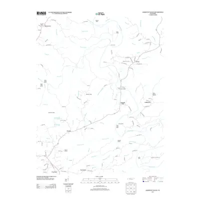
2013 Map of Harpeth Valley
USGS Topo · Published 2013About this map
Harpeth River meanders through a landscape of deep bends and high bluffs, defining the geographic character of this central Tennessee region. The river's path is marked by dramatic features such as Collier Bend, Corlew Bend, and the distinctive Narrows of the Harpeth near the southern edge. Along these shores, river crossings like Anderson Ford and Petway Ford indicate the historic points of transit that once connected local communities.
Find a feature on this map
119 named features on this map. Tap any name to fly to it.
Don’t see what you’re looking for? This feature index may not catch every label — zoom into the map to look around manually.
Map Details
Editions of this 2013 Harpeth Valley Map
This is the sole edition of this map. No revisions or reprints were ever made.
Other maps of this area

1930 · White Bluff
USGS Topo · 1:62,500

1933 · White Bluff
USGS Topo · 1:62,500

1936 · Burns
USGS Topo · 1:24,000

1953 · Burns
USGS Topo · 1:24,000

1956 · Nashville
USGS Topo · 1:250,000

1957 · Cheatham Dam
USGS Topo · 1:24,000

1957 · Ashland City
USGS Topo · 1:24,000

1958 · Charlotte
USGS Topo · 1:24,000

1958 · Cumberland Furnace
USGS Topo · 1:24,000

1959 · Nashville
USGS Topo · 1:250,000