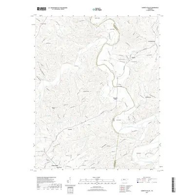
2019 Map of Harpeth Valley
USGS Topo · Published 2019About this map
The winding Harpeth River carves deep bends through the borderlands of Dickson and Cheatham counties, shaping a landscape defined by significant terrain features like Paint Rock Bluff and Sampson Ridge. In the southern reaches, the established community of White Bluff and the nearby Frog Pond sit at the edge of a network of hollows and ridges, while the isolated Nosegay Cem and Williams Cem offer critical touchpoints for family historians.
Find a feature on this map
117 named features on this map. Tap any name to fly to it.
Don’t see what you’re looking for? This feature index may not catch every label — zoom into the map to look around manually.
Map Details
Editions of this 2019 Harpeth Valley Map
This is the sole edition of this map. No revisions or reprints were ever made.
Other maps of this area

1930 · White Bluff
USGS Topo · 1:62,500

1933 · White Bluff
USGS Topo · 1:62,500

1936 · Burns
USGS Topo · 1:24,000

1953 · Burns
USGS Topo · 1:24,000

1956 · Nashville
USGS Topo · 1:250,000

1957 · Cheatham Dam
USGS Topo · 1:24,000

1957 · Ashland City
USGS Topo · 1:24,000

1958 · Charlotte
USGS Topo · 1:24,000

1958 · Cumberland Furnace
USGS Topo · 1:24,000

1959 · Nashville
USGS Topo · 1:250,000