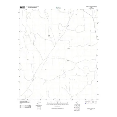
2010 Map of Harrell Canyon
USGS Topo · Published 2010About this map
Hagelstein Ranch and Herrell Ranch anchor this West Texas landscape, illustrating the enduring cattle ranching tradition of Crockett County. The terrain is defined by a network of drainage systems that have carved deep pathways through the high plains, most notably Bert Mertz Canyon and Herrell Canyon. These features, alongside Johnson Draw and Anderson Draw, reveal the vital role of ephemeral watercourses in shaping local geography and property boundaries. Man-made interventions for livestock management are evidenced by the placement of the Sulphur Trap Windmill and West Divide Windmill, critical infrastructure for securing water in an arid environment. The map provides a clear record of the rural road network and the isolation of these historic ranching outposts in the early 21st century.
Find a feature on this map
9 named features on this map. Tap any name to fly to it.
Don’t see what you’re looking for? This feature index may not catch every label — zoom into the map to look around manually.
Map Details
Editions of this 2010 Harrell Canyon Map
This is the sole edition of this map. No revisions or reprints were ever made.
Other maps of this area

1954 · Sonora
USGS Topo · 1:250,000

1958 · Sonora
USGS Topo · 1:250,000

1967 · Baggett Ranch
USGS Topo · 1:24,000

1967 · Ozona SE
USGS Topo · 1:24,000

1967 · Hunt Ranch
USGS Topo · 1:24,000

1969 · Wild Horse Canyon
USGS Topo · 1:24,000

1970 · Howards Well NE
USGS Topo · 1:24,000

1970 · Aermotor Draw
USGS Topo · 1:24,000

1970 · Indian Draw
USGS Topo · 1:24,000

1970 · Brushy Draw
USGS Topo · 1:24,000