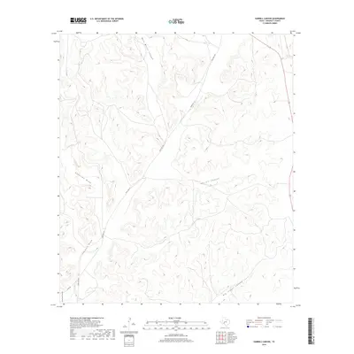
2019 Map of Harrell Canyon
USGS Topo · Published 2019About this map
Harrell Canyon and its network of deep erosional features dominate this landscape in the southern high plains of West Texas. The drainage system is characterized by the prominent Bert Mertz Canyon and Big Indian Canyon, which carve through the Edwards Plateau terrain. Human infrastructure is limited to ranch access and transportation corridors, including the winding Ranch Rd 1973 and the remote Co Rd 402. These roads follow the natural contours of the land, navigating around Anderson Draw and Johnson Draw. The map illustrates a contemporary livestock-ranching environment where the topography dictates the placement of transit routes and water management, providing a clear view of the geographic isolation and specialized land use common in this part of Crockett County.
Find a feature on this map
9 named features on this map. Tap any name to fly to it.
Don’t see what you’re looking for? This feature index may not catch every label — zoom into the map to look around manually.
Map Details
Editions of this 2019 Harrell Canyon Map
This is the sole edition of this map. No revisions or reprints were ever made.
Other maps of this area

1954 · Sonora
USGS Topo · 1:250,000

1958 · Sonora
USGS Topo · 1:250,000

1967 · Baggett Ranch
USGS Topo · 1:24,000

1967 · Ozona SE
USGS Topo · 1:24,000

1967 · Hunt Ranch
USGS Topo · 1:24,000

1969 · Wild Horse Canyon
USGS Topo · 1:24,000

1970 · Howards Well NE
USGS Topo · 1:24,000

1970 · Aermotor Draw
USGS Topo · 1:24,000

1970 · Indian Draw
USGS Topo · 1:24,000

1970 · Brushy Draw
USGS Topo · 1:24,000