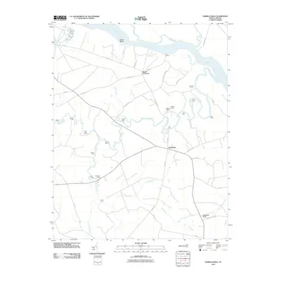
2010 Map of Harrellsville
USGS Topo · Published 2010About this map
Harrellsville and its riverine surroundings are defined by a network of historic river access points and crossroads that sustained this part of Hertford County into the early 21st century. The map illustrates a landscape tied closely to the Chowan River and the Wiccacon River, where numerous landings like Brick Cellar Landing, Wildcat Landing, and Eure Landing once served as vital commerce hubs. These waterfront sites, alongside family-named outposts such as Pollock Lodge and Snell Lodge, indicate a long-standing tradition of river-based recreation and industry.
Find a feature on this map
50 named features on this map. Tap any name to fly to it.
Don’t see what you’re looking for? This feature index may not catch every label — zoom into the map to look around manually.
Map Details
Editions of this 2010 Harrellsville Map
This is the sole edition of this map. No revisions or reprints were ever made.
Other maps of this area

1904 · Edenton
USGS Topo · 1:62,500

1906 · Beckford
USGS Topo · 1:48,000

1907 · Beckford
USGS Topo · 1:62,500

1908 · Winton
USGS Topo · 1:62,500

1940 · Beckford
USGS Topo · 1:62,500

1942 · Edenton
USGS Topo · 1:62,500

1943 · Edenton
USGS Topo · 1:62,500

1953 · Norfolk
USGS Topo · 1:250,000
1981 · Merchants Millpond
USGS Topo · 1:24,000
1981 · Gatesville
USGS Topo · 1:24,000