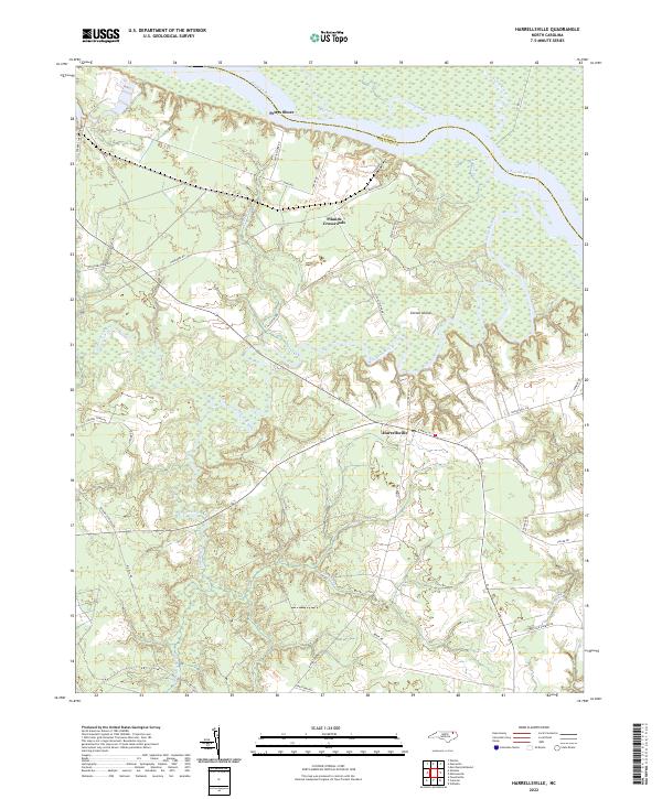
2022 Map of Harrellsville
USGS Topo · Published 2022About this map
The Chowan River defines the northeastern boundary of this landscape, winding past Pettys Shore where the waterway meets the low-lying wetlands of Gates Co and Hertford Co. This 2022 survey documents a rural environment dominated by drainage systems and tributary waters like the Wiccacon River and Barnes Creek. The settlement of Harrellsville serves as a central hub, connected to outlying points like Pilands Crossroads by a network of established local routes including Old Ferry Rd and Wiccacon Rd.
Find a feature on this map
41 named features on this map. Tap any name to fly to it.
Don’t see what you’re looking for? This feature index may not catch every label — zoom into the map to look around manually.
Map Details
Editions of this 2022 Harrellsville Map
This is the sole edition of this map. No revisions or reprints were ever made.
Other maps of this area

1904 · Edenton
USGS Topo · 1:62,500

1906 · Beckford
USGS Topo · 1:48,000

1907 · Beckford
USGS Topo · 1:62,500

1908 · Winton
USGS Topo · 1:62,500

1940 · Beckford
USGS Topo · 1:62,500

1942 · Edenton
USGS Topo · 1:62,500

1943 · Edenton
USGS Topo · 1:62,500

1953 · Norfolk
USGS Topo · 1:250,000
1981 · Merchants Millpond
USGS Topo · 1:24,000
1981 · Gatesville
USGS Topo · 1:24,000