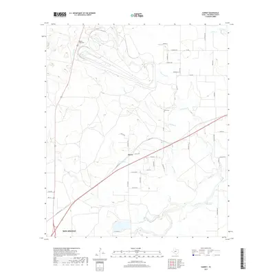
2019 Map of Harriet
USGS Topo · Published 2019About this map
Harriet sits at a geographic crossroads in Tom Green County, where the sprawling outskirts of San Angelo begin to give way to the drainage basins of the Concho River. The landscape is defined by an intricate network of seasonal waterways, including Tenmile Creek and Red Creek, which feed into the Erwin-Jordan Reservoir in the southeast. This area preserves local genealogy markers such as the Harriet Cemetery and distinctive landforms like Snake Hill. The map reveals a transition from the urban grid to a rural road system, with family-named routes like Hooper Ln and Duckworth Rd branching off from regional arteries like the Old Ballinger Hwy. This 2019 survey documents the intersection of modern infrastructure with the historical hydrography of the Texas ranch lands, capturing the area just before the more dense development of the San Angelo metropolitan area reaches these northern creeks.
Find a feature on this map
45 named features on this map. Tap any name to fly to it.
Don’t see what you’re looking for? This feature index may not catch every label — zoom into the map to look around manually.
Map Details
Editions of this 2019 Harriet Map
This is the sole edition of this map. No revisions or reprints were ever made.
Other maps of this area

1891 · Hayrick
USGS Topo · 1:125,000

1892 · San Angelo
USGS Topo · 1:125,000

1894 · Hayrick
USGS Topo · 1:125,000

1921 · Baker Flat
USGS Topo · 1:31,680

1924 · San Angelo 2-b
USGS Topo · 1:48,000

1928 · Wall
USGS Topo · 1:62,500

1954 · San Angelo
USGS Topo · 1:250,000

1957 · Eola
USGS Topo · 1:62,500

1957 · Miles
USGS Topo · 1:62,500
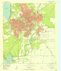
1957 · San Angelo South
USGS Topo · 1:24,000