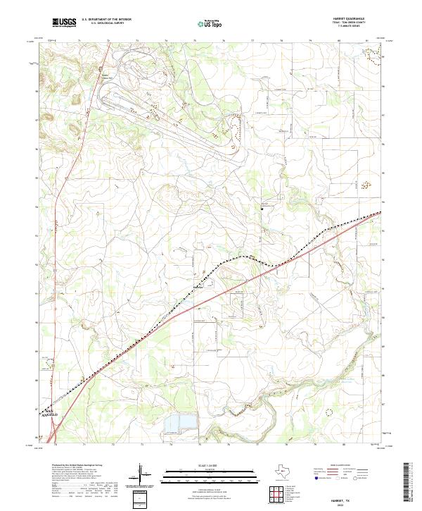
2022 Map of Harriet
USGS Topo · Published 2022About this map
Harriet sits at a crossroads of ranch roads and rural loops in this portion of Tom Green County, where the dry washes of West Texas converge toward the Concho River. The landscape is defined by its drainage network, including the meandering paths of Tenmile Cr and Red Creek, which eventually meet the river near the Erwin-Jordan Reservoir. Higher ground is marked by features like Rattle Snake Hill to the north, overlooking a terrain etched by seasonal watercourses such as Valentine Br and Crows Nest Cr.
Find a feature on this map
45 named features on this map. Tap any name to fly to it.
Don’t see what you’re looking for? This feature index may not catch every label — zoom into the map to look around manually.
Map Details
Editions of this 2022 Harriet Map
This is the sole edition of this map. No revisions or reprints were ever made.
Other maps of this area

1891 · Hayrick
USGS Topo · 1:125,000

1892 · San Angelo
USGS Topo · 1:125,000

1894 · Hayrick
USGS Topo · 1:125,000

1921 · Baker Flat
USGS Topo · 1:31,680

1924 · San Angelo 2-b
USGS Topo · 1:48,000

1928 · Wall
USGS Topo · 1:62,500

1954 · San Angelo
USGS Topo · 1:250,000

1957 · Eola
USGS Topo · 1:62,500

1957 · Miles
USGS Topo · 1:62,500
1957 · San Angelo South
USGS Topo · 1:24,000