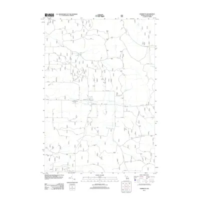
2012 Map of Harrietta
USGS Topo · Published 2012About this map
Harrietta is the primary settlement on this Michigan map, serving as a hub for local roads like W 30 Rd and Schlagle St. The area's focus on conservation and forest management is evident by the presence of the Harrietta State Fish Hatchery and the Boon Lookout Tower to the southeast. To the north, the terrain rises toward Briar Hill, while a network of waterways including Slagle Cr, Smail Cr, and Hinton Cr defines the local drainage.
Find a feature on this map
33 named features on this map. Tap any name to fly to it.
Don’t see what you’re looking for? This feature index may not catch every label — zoom into the map to look around manually.
Map Details
Editions of this 2012 Harrietta Map
This is the sole edition of this map. No revisions or reprints were ever made.
Other maps of this area

1933 · Peacock NE
USGS Topo · 1:31,680

1933 · Luther NW
USGS Topo · 1:31,680

1954 · Traverse City
USGS Topo · 1:250,000

1956 · Mesick
USGS Topo · 1:62,500

1957 · Copemish
USGS Topo · 1:62,500

1957 · Luther
USGS Topo · 1:62,500

1957 · Wellston
USGS Topo · 1:62,500

1958 · Traverse City
USGS Topo · 1:250,000
1976 · Wellston NE
USGS Topo · 1:24,000

1983 · Cadillac
USGS Topo · 1:100,000
Featured Places
- Harrietta, MI
- Antioch Township, MI
- Slagle Township, MI
- Springville Township, MI
- South Branch Township, MI