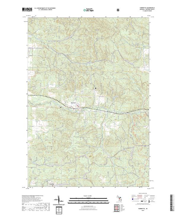
2023 Map of Harrietta
USGS Topo · Published 2023About this map
Harrietta serves as the central hub of this portion of Wexford County, located within the expansive Manistee National Forest. The village is situated along Slagle Creek and is surrounded by a dense network of local roads such as Schlagle St and the Gosman Cutoff. To the north, the terrain rises toward Briar Hill, while numerous small waterways including Smail Creek and Perkins Creek drain the surrounding wooded uplands.
Find a feature on this map
55 named features on this map. Tap any name to fly to it.
Don’t see what you’re looking for? This feature index may not catch every label — zoom into the map to look around manually.
Map Details
Editions of this 2023 Harrietta Map
This is the sole edition of this map. No revisions or reprints were ever made.
Other maps of this area

1933 · Peacock NE
USGS Topo · 1:31,680

1933 · Luther NW
USGS Topo · 1:31,680

1954 · Traverse City
USGS Topo · 1:250,000

1956 · Mesick
USGS Topo · 1:62,500

1957 · Copemish
USGS Topo · 1:62,500

1957 · Luther
USGS Topo · 1:62,500

1957 · Wellston
USGS Topo · 1:62,500

1958 · Traverse City
USGS Topo · 1:250,000
1976 · Wellston NE
USGS Topo · 1:24,000

1983 · Cadillac
USGS Topo · 1:100,000