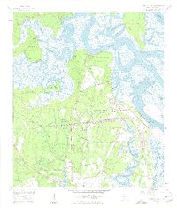
1958 Map of Harrietts Bluff
USGS Topo · Published 1959About this map
Kings Bay Army Terminal dominates the central landscape of this 1950s coastal survey, illustrating a period of significant military infrastructure development in Camden County. The map details a complex network of docks and rail spurs serving the terminal, integrated with the Seaboard Air Line railroad. To the north, the winding Crooked River creates a maze of marshes and bluffs, including Simmons Bluff and Elliotts Bluff.
Find a feature on this map
39 named features on this map. Tap any name to fly to it.
Don’t see what you’re looking for? This feature index may not catch every label — zoom into the map to look around manually.
Map Details
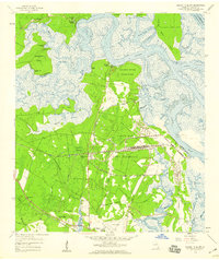
Editions of this 1958 Harrietts Bluff Map
2 editions found
Other maps of this area

1918 · St Marys
USGS Topo · 1:62,500

1918 · Cumberland Island
USGS Topo · 1:62,500

1918 · Kingsland
USGS Topo · 1:62,500

1919 · Fernandina
USGS Topo · 1:62,500

1919 · St Marys
USGS Topo · 1:62,500

1930 · Cumberland Island
USGS Topo · 1:62,500

1944 · Fernandina
USGS Topo · 1:62,500

1945 · Cumberland Island
USGS Topo · 1:62,500

1948 · Jacksonville
USGS Topo · 1:250,000

1957 · Jacksonville
USGS Topo · 1:250,000