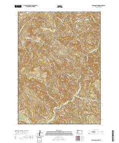
2020 Map of Harrington Creek
USGS Topo · Published 2020About this map
Middle Mountain and Brown Mtn dominate the high terrain of this Douglas County quadrangle, where a complex network of forest access roads serves the timber-rich landscape. The drainage system is particularly dense, with Harrington Cr and Rock Creek carving deep valleys through the western and southern reaches. Local landmarks such as Old Twin Cedars and Happy Rdg highlight the cultural naming conventions of the region's forestry history. Navigation through the steep drainages is facilitated by a grid of Bureau of Land Management routes, including BLM RD 1 0 and the Shoup Creek Rd. Notable water sources like Twin Cedar Spring and names like Huckleberry Sp suggest seasonal usage patterns in this remote corner of the Oregon Cascades foothills.
Find a feature on this map
46 named features on this map. Tap any name to fly to it.
Don’t see what you’re looking for? This feature index may not catch every label — zoom into the map to look around manually.
Map Details
Editions of this 2020 Harrington Creek Map
This is the sole edition of this map. No revisions or reprints were ever made.
Other maps of this area

1897 · Roseburg
USGS Topo · 1:125,000

1900 · Roseburg
USGS Topo · 1:125,000

1935 · Lowell
USGS Topo · 1:96,000

1942 · Lowell
USGS Topo · 1:125,000

1954 · Anlauf
USGS Topo · 1:62,500

1954 · Glide
USGS Topo · 1:62,500

1955 · Mace Mtn
USGS Topo · 1:62,500

1955 · Culp Creek
USGS Topo · 1:62,500

1958 · Roseburg
USGS Topo · 1:250,000

1959 · Roseburg
USGS Topo · 1:250,000