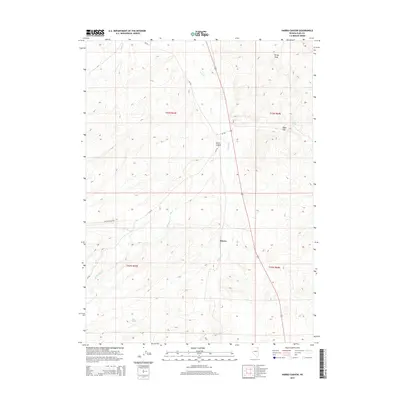
2014 Map of Harris Canyon
USGS Topo · Published 2014About this map
The high-desert terrain of Harris Canyon and the surrounding drainage basins define this northeastern Nevada landscape. A sparse network of unpaved corridors, such as Butler Ranch Rd and CR-755, facilitates access across the arid plateaus and seasonal watercourses. The presence of Shores and vital water sources like Mud Springs, Chalk Spring, and Cold Springs Cr highlights the reliance on rare springs and creeks in an environment dominated by features like Rocky Peak and Eagle Flat. The map documents a landscape where ranching infrastructure and natural drainages like Bull Camp Cr and Willow Cr remain the primary points of reference. This topographical study captures the intersection of public land management and the cattle-ranching heritage of the Great Basin.
Find a feature on this map
18 named features on this map. Tap any name to fly to it.
Don’t see what you’re looking for? This feature index may not catch every label — zoom into the map to look around manually.
Map Details
Editions of this 2014 Harris Canyon Map
This is the sole edition of this map. No revisions or reprints were ever made.
Other maps of this area

1955 · Wells
USGS Topo · 1:250,000

1958 · Wells
USGS Topo · 1:250,000

1961 · Wells
USGS Topo · 1:250,000

1968 · Wilkins
USGS Topo · 1:24,000

1968 · Knoll Mountain
USGS Topo · 1:24,000

1968 · Hubbard Basin
USGS Topo · 1:24,000

1968 · Henry
USGS Topo · 1:24,000

1968 · Wine Cup Ranch
USGS Topo · 1:24,000

1968 · Blanchard Mtn
USGS Topo · 1:24,000
1968 · Loomis Mtn
USGS Topo · 1:24,000