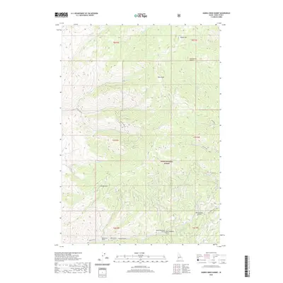
2020 Map of Harris Creek Summit
USGS Topo · Published 2020About this map
Boise Ridge dominates the skyline in this high-elevation reach of the Boise National Forest, where steep drainages and mountain summits define the geography of Boise County. The map details a complex network of canyons and gulches, including the curiously named Confederate Gulch near Hawley Mtn and the twin drainages of North Deadman Gulch and South Deadman Gulch to the south. These names often hint at the 19th-century prospecting and cattle driving history of the region. Transportation is limited to rugged routes like Porter Creek Rd and Harris Creek Rd, which provide access to Harris Creek Summit. The landscape is etched by numerous watercourses such as Shanks Cr and W Fork Granite Cr, illustrating the watershed's role in the larger Idaho drainage system.
Find a feature on this map
35 named features on this map. Tap any name to fly to it.
Don’t see what you’re looking for? This feature index may not catch every label — zoom into the map to look around manually.
Map Details
Editions of this 2020 Harris Creek Summit Map
This is the sole edition of this map. No revisions or reprints were ever made.
Other maps of this area

1892 · Boise
USGS Topo · 1:125,000

1894 · Squaw Creek
USGS Topo · 1:125,000

1894 · Idaho Basin
USGS Topo · 1:125,000

1897 · Boise
USGS Topo · 1:125,000

1909 · Garden Valley
USGS Topo · 1:125,000

1953 · Banks
USGS Topo · 1:62,500

1955 · Baker
USGS Topo · 1:250,000

1955 · Hailey
USGS Topo · 1:250,000

1955 · Boise
USGS Topo · 1:250,000

1957 · Cartwright Canyon
USGS Topo · 1:24,000