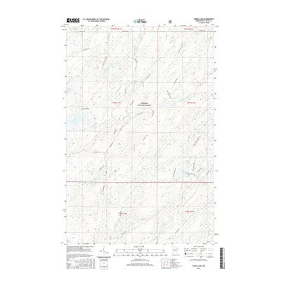
2016 Map of Harris Lake
USGS Topo · Published 2016About this map
Superior National Forest encompasses this section of northern Minnesota, where the drainage of the Whiteface River system defines the landscape. The North Branch Whiteface River and South Branch Whiteface River wind through a dense network of wetlands and small lakes, including Pequaywan Lake and Linwood Lake. A significant portion of the Whiteface Reservoir is visible in the west, while the eastern portion of the map is dominated by Harris Lake and Otto Harris Lake. The topography is anchored by Pietila Mountain, a notable elevation point in an area otherwise characterized by water bodies and forest access roads. Local infrastructure is sparse, represented by routes such as NE Grade Rd and Hagstrom Rd, reflecting a region largely dedicated to timber management and outdoor recreation within the national forest boundaries.
Find a feature on this map
35 named features on this map. Tap any name to fly to it.
Don’t see what you’re looking for? This feature index may not catch every label — zoom into the map to look around manually.
Map Details
Editions of this 2016 Harris Lake Map
This is the sole edition of this map. No revisions or reprints were ever made.
Other maps of this area

1954 · Two Harbors
USGS Topo · 1:250,000

1954 · Hibbing
USGS Topo · 1:250,000

1956 · Pequaywan Lake
USGS Topo · 1:24,000

1957 · Two Harbors
USGS Topo · 1:250,000

1957 · Hibbing
USGS Topo · 1:250,000

1957 · Brimson
USGS Topo · 1:62,500

1957 · Markham
USGS Topo · 1:62,500

1957 · Comstock Lake
USGS Topo · 1:24,000
1957 · Boulder Lake Reservoir NE
USGS Topo · 1:24,000

1958 · Hibbing
USGS Topo · 1:250,000