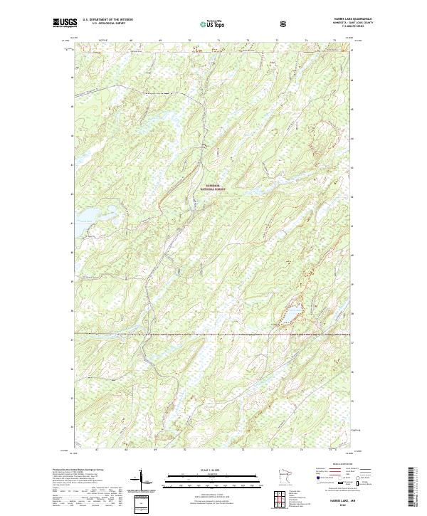
2022 Map of Harris Lake
USGS Topo · Published 2022About this map
The Superior National Forest encompasses this vast wetland and woodland landscape in St. Louis County, where the hydrology is defined by the splitting branches of the Whiteface River. The North Branch Whiteface River and South Branch Whiteface River weave through dense forest, fed by numerous creeks including Burn Cr, Reno Cr, and Wallow Creek. This remote terrain is navigated by a network of forest service roads and specialized trails, many bearing the names of local families and historic logging routes, such as Hagstrom Rd, Savolaine Road, and Reagan Road Assoc. Settlement is sparse and concentrated near the water, particularly around Linwood Lake and its associated access ways like Linwood Shores Rd. Further east, the namesake Harris Lake remains more isolated, accessible primarily via the Harris Lake Trl.
Find a feature on this map
50 named features on this map. Tap any name to fly to it.
Don’t see what you’re looking for? This feature index may not catch every label — zoom into the map to look around manually.
Map Details
Editions of this 2022 Harris Lake Map
This is the sole edition of this map. No revisions or reprints were ever made.
Other maps of this area

1954 · Two Harbors
USGS Topo · 1:250,000

1954 · Hibbing
USGS Topo · 1:250,000

1956 · Pequaywan Lake
USGS Topo · 1:24,000

1957 · Two Harbors
USGS Topo · 1:250,000

1957 · Hibbing
USGS Topo · 1:250,000

1957 · Brimson
USGS Topo · 1:62,500

1957 · Markham
USGS Topo · 1:62,500

1957 · Comstock Lake
USGS Topo · 1:24,000
1957 · Boulder Lake Reservoir NE
USGS Topo · 1:24,000

1958 · Hibbing
USGS Topo · 1:250,000