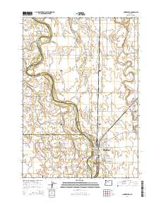
2014 Map of Harrisburg
USGS Topo · Published 2014About this map
The Willamette River defines the western edge of this valley landscape, its winding course creating a series of large islands and side channels including Morgan Island, Dodge Island, and Ingram Island. At the heart of the region sits Harrisburg, a settlement positioned near the river's bank where local roads like Or-99e and Priceboro DR converge. Further south, the map identifies Lancaster, another community hub situated near the Perkins Slough.
Find a feature on this map
72 named features on this map. Tap any name to fly to it.
Don’t see what you’re looking for? This feature index may not catch every label — zoom into the map to look around manually.
Map Details
Editions of this 2014 Harrisburg Map
This is the sole edition of this map. No revisions or reprints were ever made.
Other maps of this area

1909 · Harrisburg
USGS Topo · 1:31,680

1909 · Rowland
USGS Topo · 1:31,680

1909 · Elmira
USGS Topo · 1:62,500

1910 · Eugene
USGS Topo · 1:62,500

1911 · Monroe
USGS Topo · 1:31,680

1911 · Inavale
USGS Topo · 1:31,680

1912 · Halsey
USGS Topo · 1:62,500

1922 · Monroe
USGS Topo · 1:62,500

1922 · Elmira
USGS Topo · 1:62,500

1939 · Monroe
USGS Topo · 1:62,500