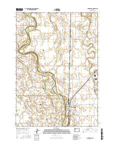
2017 Map of Harrisburg
USGS Topo · Published 2017About this map
The Willamette River defines this portion of the valley, winding through a complex system of islands and sloughs such as Ingram Island, Morgan Island, and Perkins Slough. In the south, Harrisburg serves as a primary riverfront hub, while the smaller settlement of Lancaster sits further west near the border of Lane and Benton counties. The landscape is dotted with small family and fraternal burial grounds, including the Masonic Cem, Independent Order of Odd Fellows Cem, and the Lancaster-Young Cem, providing significant points of interest for genealogical research. The river's influence is evident in the many named bends and islands, like Irish Bend and Dodge Island, which highlight the shifting waterways that historically shaped local land use and transportation in Linn County.
Find a feature on this map
79 named features on this map. Tap any name to fly to it.
Don’t see what you’re looking for? This feature index may not catch every label — zoom into the map to look around manually.
Map Details
Editions of this 2017 Harrisburg Map
This is the sole edition of this map. No revisions or reprints were ever made.
Other maps of this area

1909 · Harrisburg
USGS Topo · 1:31,680

1909 · Rowland
USGS Topo · 1:31,680

1909 · Elmira
USGS Topo · 1:62,500

1910 · Eugene
USGS Topo · 1:62,500

1911 · Monroe
USGS Topo · 1:31,680

1911 · Inavale
USGS Topo · 1:31,680

1912 · Halsey
USGS Topo · 1:62,500

1922 · Monroe
USGS Topo · 1:62,500

1922 · Elmira
USGS Topo · 1:62,500

1939 · Monroe
USGS Topo · 1:62,500