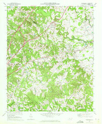
1969 Map of Harrisburg
USGS Topo · Published 1972About this map
The Cabarrus Co and Mecklenburg Co border defines this 1969 landscape, where the rural Piedmont was beginning to transform under the influence of nearby Charlotte. The Southern railroad corridor anchors the small community of Harrisburg, while institutional growth is evident at the Univ of North Carolina at Charlotte and the Charlotte Motor Speedway. This survey records an era of transition, where established rural landmarks like Back Creek Chapel, Newell Sch, and Stowes Chapel sit alongside newer infrastructure including several radio towers and a landing strip.
Find a feature on this map
46 named features on this map. Tap any name to fly to it.
Don’t see what you’re looking for? This feature index may not catch every label — zoom into the map to look around manually.
Map Details
Editions of this 1969 Harrisburg Map
2 editions found
Other maps of this area

1905 · Charlotte
USGS Topo · 1:48,000

1907 · Charlotte
USGS Topo · 1:62,500

1941 · Charlotte
USGS Topo · 1:125,000

1942 · Charlotte
USGS Topo · 1:125,000

1948 · Derita
USGS Topo · 1:24,000

1948 · Charlotte East
USGS Topo · 1:24,000

1949 · Kannapolis
USGS Topo · 1:24,000

1949 · Charlotte East
USGS Topo · 1:24,000

1949 · Harrisburg
USGS Topo · 1:24,000

1949 · Wilgrove
USGS Topo · 1:24,000