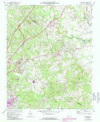
1969 Map of Harrisburg
USGS Topo · Published 1988About this map
The boundary between Cabarrus Co and Mecklenburg Co bisects this landscape, which in the late 1960s was transitioning from a rural piedmont setting into an institutional and recreational hub. The establishment of the Univ of North Carolina at Charlotte and the Charlotte Motor Speedway north of Rocky River mark significant shifts in land use near the Charlotte city limits. This era shows the older, established foundations of the community, such as the industrial site at Roberta Mills and the local center of Harrisburg. Numerous country churches and cemeteries, including Mallard Creek Ch and Siloam Cem, are distributed across the drainage basins of Mallard Creek and Back Creek. The map also captures several smaller settlements like Newell, featuring its own Newell Sch, and Torrence Grove Ch, alongside the emerging residential patterns indicated by various trailer parks and the purple-tinted urban extensions.
Find a feature on this map
44 named features on this map. Tap any name to fly to it.
Don’t see what you’re looking for? This feature index may not catch every label — zoom into the map to look around manually.
Map Details
Editions of this 1969 Harrisburg Map
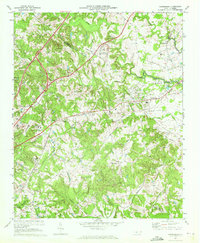
2 editions found
Other maps of this area

1905 · Charlotte
USGS Topo · 1:48,000

1907 · Charlotte
USGS Topo · 1:62,500

1941 · Charlotte
USGS Topo · 1:125,000

1942 · Charlotte
USGS Topo · 1:125,000

1948 · Derita
USGS Topo · 1:24,000

1948 · Charlotte East
USGS Topo · 1:24,000

1949 · Kannapolis
USGS Topo · 1:24,000

1949 · Charlotte East
USGS Topo · 1:24,000

1949 · Harrisburg
USGS Topo · 1:24,000

1949 · Wilgrove
USGS Topo · 1:24,000