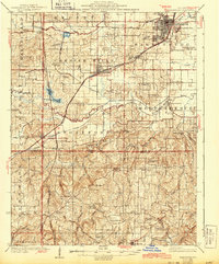
1925 Map of Harrisburg
USGS Topo · Published 1943About this map
The Cleveland Cincinnati Chicago and St Louis railroad corridor anchors the northern Saline County landscape, connecting the industrial operations of Wasson Mine No 2 to the regional hubs of Harrisburg and Carrier Mills. This era of Southern Illinois history is defined by its rural density, evidenced by dozens of one-room schoolhouses like Luke View School and Pierson School that served farmstead families before consolidation.
Find a feature on this map
96 named features on this map. Tap any name to fly to it.
Don’t see what you’re looking for? This feature index may not catch every label — zoom into the map to look around manually.
Map Details
Editions of this 1925 Harrisburg Map
3 editions found

Other maps of this area

1905 · Eldorado
USGS Topo · 1:62,500

1906 · Eldorado
USGS Topo · 1:62,500

1908 · Galatia
USGS Topo · 1:62,500

1909 · West Frankfort
USGS Topo · 1:62,500

1916 · Golconda
USGS Topo · 1:62,500

1916 · Equality
USGS Topo · 1:62,500

1917 · Brownfield
USGS Topo · 1:62,500

1918 · Vienna
USGS Topo · 1:62,500

1919 · Vienna
USGS Topo · 1:62,500

1920 · Goloonda
USGS Topo · 1:48,000