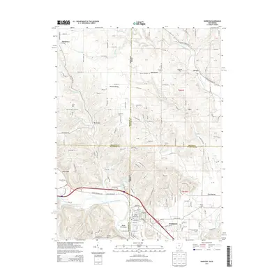
2013 Map of Harrison
USGS Topo · Published 2013About this map
Harrison stands as a pivotal border town where the Indiana-Ohio state line bisects the community, creating a unique twin-settlement dynamic with West Harrison. This 2013 survey reveals a landscape defined by the drainage of the Whitewater River and its major tributary, the Dry Fork Whitewater River. The area maintains a high density of rural heritage sites, particularly along the winding Harrison Brookville Rd and Old US Highway 52. Genealogists will find a significant concentration of burial grounds, including the Saint Johns Catholic Cem and Woodlawn Cem. In the northern reaches, smaller hamlets like Okeana, Macedonia, and Drewersburg illustrate the persistent settlement patterns of the region's agricultural uplands, while landmarks such as the Cincinnati West Airport reflect the modern infrastructure supporting this tristate corridor.
Find a feature on this map
112 named features on this map. Tap any name to fly to it.
Don’t see what you’re looking for? This feature index may not catch every label — zoom into the map to look around manually.
Map Details
Editions of this 2013 Harrison Map
This is the sole edition of this map. No revisions or reprints were ever made.
Other maps of this area

1914 · West Cincinnati
USGS Topo · 1:62,500

1915 · Lawrenceburg
USGS Topo · 1:48,000

1915 · Harrison
USGS Topo · 1:48,000

1915 · Hamilton
USGS Topo · 1:62,500

1917 · Hamilton
USGS Topo · 1:62,500

1928 · Lawrenceburg
USGS Topo · 1:62,500

1932 · Lawrenceburg
USGS Topo · 1:62,500

1943 · Hooven
USGS Topo · 1:24,000

1943 · Guilford
USGS Topo · 1:24,000

1953 · Guilford
USGS Topo · 1:24,000