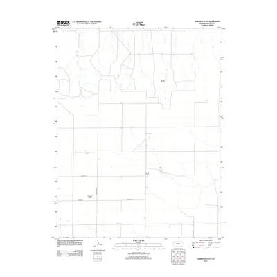
2012 Map of Harrison Flats
USGS Topo · Published 2012About this map
Harrison Flats occupies the open landscape of Wallace County in this 2012 USGS survey, where the high plains of western Kansas are defined by a strictly organized section-line road network. The terrain is largely level until it reaches the more complex topography of Wallace Bluffs, where the ground breaks toward the drainage of Coon Cr. This map documents a modern snapshot of rural agriculture, tracing the straight-line paths of Road WA S-26 and Road WA E-G as they intersect the quiet settlement of Harrison Flats. The sparse placement of structures and the dominance of the survey grid reflect the enduring character of the high plains, providing a precise record of land use and transportation routes at the start of the 2010s.
Find a feature on this map
8 named features on this map. Tap any name to fly to it.
Don’t see what you’re looking for? This feature index may not catch every label — zoom into the map to look around manually.
Map Details
Editions of this 2012 Harrison Flats Map
This is the sole edition of this map. No revisions or reprints were ever made.
Other maps of this area

1955 · Scott City
USGS Topo · 1:250,000

1958 · Scott City
USGS Topo · 1:250,000

1959 · Wallace
USGS Topo · 1:62,500

1968 · Russell Springs 3 NW
USGS Topo · 1:24,000

1968 · Sharon Springs 4 NW
USGS Topo · 1:24,000

1968 · Sharon Springs 4 NE
USGS Topo · 1:24,000

1969 · Russell Springs 2 NW
USGS Topo · 1:24,000

1969 · Russell Springs 2 SW
USGS Topo · 1:24,000
1979 · Wallace
USGS Topo · 1:24,000
1979 · Sharon Springs East
USGS Topo · 1:24,000