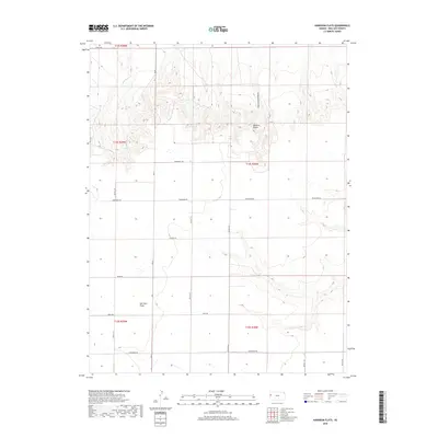
2018 Map of Harrison Flats
USGS Topo · Published 2018About this map
Harrison Flats occupies the open plains of western Kansas, where a systematic grid of county roads defines the agricultural landscape of Wallace County. The terrain is marked by significant geographic transitions, particularly where the plateau breaks away into the Wallace Bluffs and the etched drainage of Homestead Canyon to the north. These topographical features provide a sharp contrast to the level fields that dominate the southern half of the quadrangle.
Find a feature on this map
21 named features on this map. Tap any name to fly to it.
Don’t see what you’re looking for? This feature index may not catch every label — zoom into the map to look around manually.
Map Details
Editions of this 2018 Harrison Flats Map
This is the sole edition of this map. No revisions or reprints were ever made.
Other maps of this area

1955 · Scott City
USGS Topo · 1:250,000

1958 · Scott City
USGS Topo · 1:250,000

1959 · Wallace
USGS Topo · 1:62,500

1968 · Russell Springs 3 NW
USGS Topo · 1:24,000

1968 · Sharon Springs 4 NW
USGS Topo · 1:24,000

1968 · Sharon Springs 4 NE
USGS Topo · 1:24,000

1969 · Russell Springs 2 NW
USGS Topo · 1:24,000

1969 · Russell Springs 2 SW
USGS Topo · 1:24,000
1979 · Wallace
USGS Topo · 1:24,000
1979 · Sharon Springs East
USGS Topo · 1:24,000