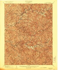
1907 Map of Harrisville
USGS Topo · Published 1921About this map
Harrisville serves as the focal point for this survey of the central West Virginia hills, conducted just after the turn of the century. The region is defined by the winding courses of the North Fork Hughes River and South Fork Hughes River, whose deep valleys dictated the path of the Baltimore and Ohio RR. This rail line connects several small community hubs, including Cairo and Cornwallis, which functioned as critical transit points for the local rural economy.
Find a feature on this map
37 named features on this map. Tap any name to fly to it.
Don’t see what you’re looking for? This feature index may not catch every label — zoom into the map to look around manually.
Map Details
Editions of this 1907 Harrisville Map
2 editions found
Other maps of this area

1893 · Sutton
USGS Topo · 1:125,000

1904 · Marietta
USGS Topo · 1:62,500

1905 · West Union
USGS Topo · 1:62,500

1906 · Saint Marys
USGS Topo · 1:62,500

1906 · Holbrook
USGS Topo · 1:62,500

1906 · Glenville
USGS Topo · 1:62,500

1906 · Elizabeth
USGS Topo · 1:62,500

1907 · Harrisville
USGS Topo · 1:62,500

1907 · Arnoldsburg
USGS Topo · 1:62,500

1907 · Spencer
USGS Topo · 1:62,500