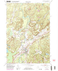
1951 Map of Harrisville
USGS Topo · Published 1983About this map
The Oswegatchie River and its West Branch dominate this mid-century landscape on the border of St. Lawrence and Lewis Counties. The village of Harrisville serves as the primary hub, where the Conrail line skirts the riverbanks near several state-managed lands, including Bonaparte Cave State Forest and the northern reaches of the Adirondack Park.
Find a feature on this map
50 named features on this map. Tap any name to fly to it.
Don’t see what you’re looking for? This feature index may not catch every label — zoom into the map to look around manually.
Map Details
Editions of this 1951 Harrisville Map
4 editions found
Other maps of this area

1913 · Lake Bonaparte
USGS Topo · 1:62,500

1915 · Gouverneur
USGS Topo · 1:62,500

1915 · Russell
USGS Topo · 1:62,500

1916 · Lake Bonaparte
USGS Topo · 1:62,500

1916 · Oswegatchie
USGS Topo · 1:62,500

1918 · Russell
USGS Topo · 1:62,500

1918 · Oswegatchie
USGS Topo · 1:62,500

1937 · Gouverneur
USGS Topo · 1:62,500

1948 · Ogdensburg
USGS Topo · 1:250,000

1951 · Ogdensburg
USGS Topo · 1:250,000