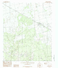
1983 Map of Harrold
USGS Topo · Published 1984About this map
Harrold serves as the central hub of this Wilbarger County landscape, appearing here as it was documented in the early 1980s. The settlement's layout is defined by the intersection of the regional road network and the railroad, with a local Cem situated just outside the residential center. The surrounding terrain is heavily influenced by the energy industry, as evidenced by the extensive Oil Field operations that dot the plains between seasonal watercourses.
Find a feature on this map
8 named features on this map. Tap any name to fly to it.
Don’t see what you’re looking for? This feature index may not catch every label — zoom into the map to look around manually.
Map Details
Editions of this 1983 Harrold Map
2 editions found
Other maps of this area

1916 · Electra
USGS Topo · 1:24,000

1917 · Beaver Creek
USGS Topo · 1:24,000

1918 · Electra
USGS Topo · 1:31,680

1920 · Beaver Creek
USGS Topo · 1:31,680

1954 · Wichita Falls
USGS Topo · 1:250,000

1955 · Lawton
USGS Topo · 1:250,000

1958 · Wichita Falls
USGS Topo · 1:250,000

1958 · Davidson
USGS Topo · 1:62,500

1958 · Electra
USGS Topo · 1:62,500

1966 · Grayback
USGS Topo · 1:24,000