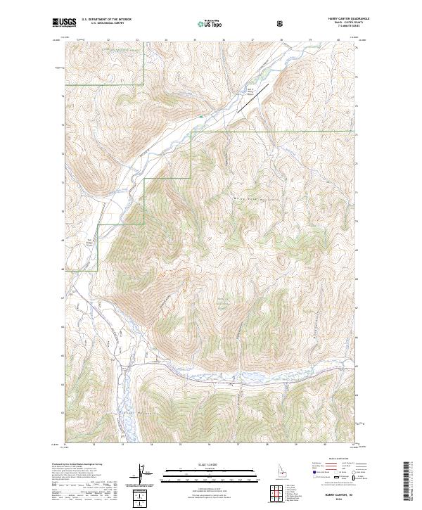
2024 Map of Harry Canyon
USGS Topo · Published 2024About this map
The White Knob Mountains and Pioneer Mountains converge in this high-altitude landscape within the Challis National Forest. The drainage patterns of the Big Lost River and the East Fork Big Lost River dictate the topography, carving prominent features such as Harry Canyon and Wildcat Canyon. This modern survey illustrates a remote region characterized by specialized aviation access, marked by the Star 'S' Ranch Airport and Twin Bridges Airport. Travel through the terrain is largely confined to established forest routes like Trail Creek Rd and Wild Horse Creek Rd, reflecting the area's protected status within the Jim McClure-Jerry Peak Wilderness. The map provides a look at the hydrography of the interior, from Banana Gulch to the seasonal flows of Dry Canyon.
Find a feature on this map
49 named features on this map. Tap any name to fly to it.
Don’t see what you’re looking for? This feature index may not catch every label — zoom into the map to look around manually.
Map Details
Editions of this 2024 Harry Canyon Map
This is the sole edition of this map. No revisions or reprints were ever made.
Other maps of this area

1895 · Hailey
USGS Topo · 1:125,000

1897 · Hailey
USGS Topo · 1:125,000

1929 · Bayhorse
USGS Topo · 1:125,000

1935 · MacKay
USGS Topo · 1:96,000

1935 · Borah Peak
USGS Topo · 1:125,000

1938 · Borah Peak
USGS Topo · 1:125,000

1955 · Dubois
USGS Topo · 1:250,000

1955 · Idaho Falls
USGS Topo · 1:250,000

1955 · Hailey
USGS Topo · 1:250,000

1957 · Challis
USGS Topo · 1:250,000