1967 Map of Hart Lake
USGS Topo · Published 1984About this map
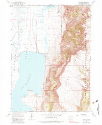
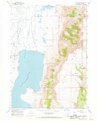
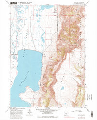
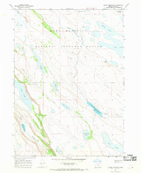
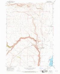
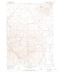
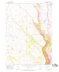
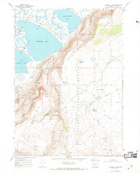
The Hart Mountain National Antelope Refuge dominates the eastern half of this 1960s landscape, rising sharply above the Warner Valley Lakes. This transition from the aquatic basin to the steep slopes of Hart Mountain National Antelope Refuge is defined by dramatic erosional features like Arsenic Canyon and De Garmo Canyon. The hydrology of the region is centered on the expansive waters of Hart Lake, which maintains a normal pool elevation of 4473 feet, and the smaller Anderson Lake to the north. Evidence of human land management in this high desert environment is sparse but visible through the presence of a Jeep Trail, a remote Well, and a Pump. Industrial activity is limited to a small Gravel Pit and Sandpit located near a Spillway along the eastern shore, providing a glimpse into the localized infrastructure of the mid-20th century.
Find a feature on this map
25 named features on this map. Tap any name to fly to it.
Don’t see what you’re looking for? This feature index may not catch every label — zoom into the map to look around manually.
Map Details
Editions of this 1967 Hart Lake Map
3 editions found
Other maps of this area

1955 · Adel
USGS Topo · 1:250,000

1957 · Adel
USGS Topo · 1:250,000

1958 · Adel
USGS Topo · 1:250,000

1962 · Adel
USGS Topo · 1:250,000
1967 · Flagstaff Lake
USGS Topo · 1:24,000
1967 · Jacobs Reservoir
USGS Topo · 1:24,000
1967 · Plush
USGS Topo · 1:24,000
1967 · Rabbit Hills SW
USGS Topo · 1:24,000
1967 · Priday Reservoir
USGS Topo · 1:24,000
1967 · Campbell Lake
USGS Topo · 1:24,000