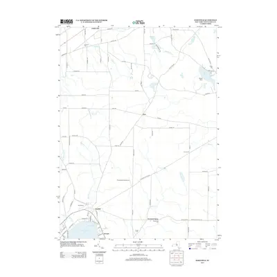
2013 Map of Hartfield
USGS Topo · Published 2013About this map
Chautauqua Lake anchors this part of western New York, feeding into Hartfield Bay near the crossroads of Hartfield. The landscape is a mosaic of small drainages like Big Inlet and Little Inlet that flow toward the larger lake, while the northern terrain is marked by smaller bodies of water such as Bear Lake, Brocton Reservoir, and Burr Reservoir. This 2013 survey illustrates the area's transition from rural townships to recreational and utility hubs, including the Chautauqua Lake Airpark and Dart Airport.
Find a feature on this map
83 named features on this map. Tap any name to fly to it.
Don’t see what you’re looking for? This feature index may not catch every label — zoom into the map to look around manually.
Map Details
Editions of this 2013 Hartfield Map
This is the sole edition of this map. No revisions or reprints were ever made.
Other maps of this area

1899 · Westfield
USGS Topo · 1:62,500

1900 · Dunkirk
USGS Topo · 1:62,500

1904 · Chautaqua
USGS Topo · 1:62,500

1905 · Clymer
USGS Topo · 1:62,500

1939 · Clymer
USGS Topo · 1:62,500

1941 · Chautauqua
USGS Topo · 1:62,500

1941 · Clymer
USGS Topo · 1:62,500

1943 · Dunkirk
USGS Topo · 1:62,500

1954 · Chautauqua
USGS Topo · 1:24,000

1954 · Ellery Center
USGS Topo · 1:24,000