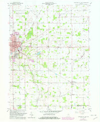
1960 Map of Hartford City East
USGS Topo · Published 1982About this map
Hartford City serves as the focal point for this 1960 survey of Blackford County, showing the community just before the widespread modernization of its outskirts. The eastern edge of the city is dense with civic landmarks, from the Courthouse and City Hall to the Fairgrounds and Armory. Beyond the residential streets, the landscape transitions into a grid of agricultural land defined by an extensive network of drainage features like Slocum Ditch and Jones Ditch, essential for farming the Indiana plains.
Find a feature on this map
48 named features on this map. Tap any name to fly to it.
Don’t see what you’re looking for? This feature index may not catch every label — zoom into the map to look around manually.
Map Details
Editions of this 1960 Hartford City East Map
Other maps of this area

1953 · Muncie
USGS Topo · 1:250,000

1956 · Muncie
USGS Topo · 1:250,000

1960 · Pennville
USGS Topo · 1:24,000

1960 · Hartford City East
USGS Topo · 1:24,000

1960 · Eaton
USGS Topo · 1:24,000

1960 · Wheeling
USGS Topo · 1:24,000
1960 · Redkey
USGS Topo · 1:24,000

1960 · Hartford City West
USGS Topo · 1:24,000

1962 · Montpelier
USGS Topo · 1:24,000

1962 · Roll
USGS Topo · 1:24,000