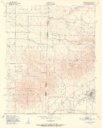
1951 Map of Hartford
USGS Topo · Published 1951About this map
Hartford and West Hartford anchor the southeastern corner of this map, reflecting the mid-century industrial activity of Sebastian Co along the border with Oklahoma. The landscape is defined by significant coal mining operations, with multiple Coal labels marking the hillsides surrounding the town center. To the west and north, the terrain rises sharply into the landforms of Sugar Loaf Mountain, Midland Peak, and Oklahoma Peak, which dominate the skyline above the winding paths of Sugar Loaf Creek and Riddle Creek.
Find a feature on this map
24 named features on this map. Tap any name to fly to it.
Don’t see what you’re looking for? This feature index may not catch every label — zoom into the map to look around manually.
Map Details
Editions of this 1951 Hartford Map
2 editions found
Other maps of this area

1887 · Poteau Mountain #2
USGS Topo · 1:62,500

1887 · Greenwood
USGS Topo · 1:62,500

1890 · Fort Smith
USGS Topo · 1:125,000

1890 · Poteau Mountain
USGS Topo · 1:125,000

1899 · Poteau Mountain
USGS Topo · 1:125,000

1900 · Sallisaw
USGS Topo · 1:125,000

1900 · Winding Stair
USGS Topo · 1:125,000

1909 · Winding Stair
USGS Topo · 1:125,000

1911 · Sallisaw
USGS Topo · 1:125,000

1943 · Fort Smith
USGS Topo · 1:125,000