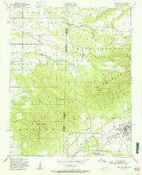
1951 Map of Hartford
USGS Topo · Published 1951About this map
Hartford and West Hartford anchor the eastern landscape of this 1951 survey, situated along the border where Oklahoma and Arkansas meet. The geography is defined by significant elevations, including the prominent Sugar Loaf Mountain and Midland Peak, which rise above the surrounding valleys. A specialized economy is evident near the town center, where Coal extraction points to the region's industrial ties.
Find a feature on this map
24 named features on this map. Tap any name to fly to it.
Don’t see what you’re looking for? This feature index may not catch every label — zoom into the map to look around manually.
Map Details
Editions of this 1951 Hartford Map
2 editions found
Other maps of this area

1887 · Poteau Mountain #2
USGS Topo · 1:62,500

1887 · Greenwood
USGS Topo · 1:62,500

1890 · Fort Smith
USGS Topo · 1:125,000

1890 · Poteau Mountain
USGS Topo · 1:125,000

1899 · Poteau Mountain
USGS Topo · 1:125,000

1900 · Sallisaw
USGS Topo · 1:125,000

1900 · Winding Stair
USGS Topo · 1:125,000

1909 · Winding Stair
USGS Topo · 1:125,000

1911 · Sallisaw
USGS Topo · 1:125,000

1943 · Fort Smith
USGS Topo · 1:125,000