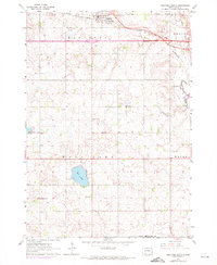
1962 Map of Hartford South
USGS Topo · Published 1972About this map
Hartford serves as the primary hub in this prairie landscape, where the Chicago and North Western rail line and Interstate 90 intersect. The map documents a dense network of rural infrastructure, from local places of worship like Zion Ch and Trinity Ch to the several country schoolhouses that once dotted the townships, including Sunshine Sch and Johnson Sch.
Find a feature on this map
22 named features on this map. Tap any name to fly to it.
Don’t see what you’re looking for? This feature index may not catch every label — zoom into the map to look around manually.
Map Details
Editions of this 1962 Hartford South Map
2 editions found
Other maps of this area

1897 · Canton
USGS Topo · 1:125,000

1898 · Parker
USGS Topo · 1:125,000

1900 · Canton
USGS Topo · 1:125,000

1955 · Sioux Falls
USGS Topo · 1:250,000

1958 · Sioux Falls
USGS Topo · 1:250,000

1962 · Tea
USGS Topo · 1:24,000

1962 · Hartford South
USGS Topo · 1:24,000

1962 · Lennox NW
USGS Topo · 1:24,000

1962 · Hartford North
USGS Topo · 1:24,000

1962 · Sioux Falls West
USGS Topo · 1:24,000