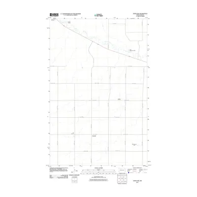
2011 Map of Hartland
USGS Topo · Published 2011About this map
The settlement of Hartland serves as the focal point for this 2011 survey, situated in a landscape defined by the winding course of the Des Lacs River as it cuts through Ward County. The terrain is marked by significant topographical depressions, notably Goettle Coulee and Carl Feldner Coulee, which disrupt the otherwise orderly grid of section roads. This survey is particularly valuable for genealogical research, as it identifies several community burial grounds including Saint Anthony Cemetery in the northwest, Johnson Cemetery to the east, and Zion Cemetery near the heart of the township.
Find a feature on this map
23 named features on this map. Tap any name to fly to it.
Don’t see what you’re looking for? This feature index may not catch every label — zoom into the map to look around manually.
Map Details
Editions of this 2011 Hartland Map
This is the sole edition of this map. No revisions or reprints were ever made.
Other maps of this area

1947 · Tolley
USGS Topo · 1:62,500

1948 · Donnybrook
USGS Topo · 1:24,000

1949 · Tolley SE
USGS Topo · 1:24,000

1949 · Hartland
USGS Topo · 1:24,000

1949 · Carpio
USGS Topo · 1:24,000

1949 · Grano SW
USGS Topo · 1:24,000

1950 · Tolley
USGS Topo · 1:62,500
1951 · Grano
USGS Topo · 1:62,500

1954 · Minot
USGS Topo · 1:250,000

1958 · Minot
USGS Topo · 1:250,000