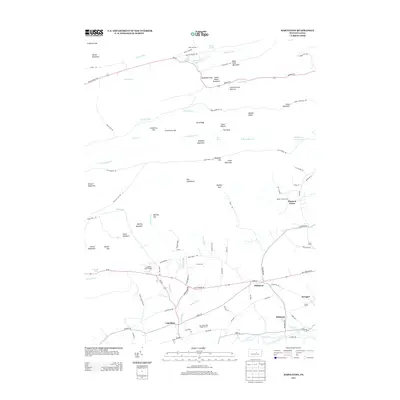
2013 Map of Hartleton
USGS Topo · Published 2013About this map
The Laurelton State Village complex and its accompanying Laurelton State Village Farms anchor the western valley of this 2013 topographic study. This central Pennsylvania landscape is defined by a series of prominent ridges and gaps, including Seven Notch Mountain, Bake Oven Mountain, and the narrow passage of Fourteenmile Narrows to the north. Settlement is concentrated along the historic east-west corridor of the Old Turnpike Rd, where the towns of Hartleton, Laurelton, Swengel, and Millmont are situated between the high ground and the winding course of Penns Creek. The map reveals a complex water system supporting the region, from the Mifflinburg Reservoir tucked against Jones Mountain to the curiously named The Little Bubbler near Halfway Lake. Numerous mountain gaps like Buffalo Gap and Stitzer Gap indicate the natural transit points used by local roads to navigate the steep topography of the Bald Eagle State Forest region.
Find a feature on this map
101 named features on this map. Tap any name to fly to it.
Don’t see what you’re looking for? This feature index may not catch every label — zoom into the map to look around manually.
Map Details
Editions of this 2013 Hartleton Map
This is the sole edition of this map. No revisions or reprints were ever made.
Other maps of this area

1921 · Williamsport
USGS Topo · 1:48,000

1921 · Lock Haven
USGS Topo · 1:62,500

1923 · Lock Haven
USGS Topo · 1:62,500

1923 · Williamsport
USGS Topo · 1:62,500

1937 · Millheim
USGS Topo · 1:48,000

1938 · Mifflinburg
USGS Topo · 1:48,000

1941 · Millheim
USGS Topo · 1:62,500

1943 · Mifflinburg
USGS Topo · 1:62,500

1944 · Williamsport
USGS Topo · 1:62,500

1944 · Lock Haven
USGS Topo · 1:62,500