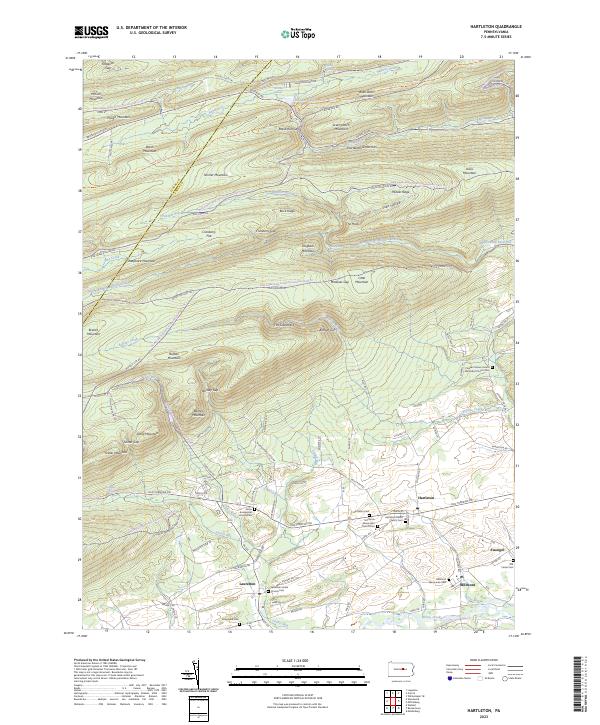
2023 Map of Hartleton
USGS Topo · Published 2023About this map
Hartleton and the neighboring villages of Laurelton, Millmont, and Swengel sit within a valley defined by the steep ridges of the Bald Eagle State Forest. The settlement pattern follows the corridor of the Old Turnpike Rd, which serves as the primary artery connecting these rural communities. The cultural landscape is heavily marked by religious and genealogical sites, including the Hartleton Union Church and numerous denominational burial grounds like the Millmont Mennonite Church Cem and Long Lane Cem.
Find a feature on this map
117 named features on this map. Tap any name to fly to it.
Don’t see what you’re looking for? This feature index may not catch every label — zoom into the map to look around manually.
Map Details
Editions of this 2023 Hartleton Map
This is the sole edition of this map. No revisions or reprints were ever made.
Other maps of this area

1921 · Williamsport
USGS Topo · 1:48,000

1921 · Lock Haven
USGS Topo · 1:62,500

1923 · Lock Haven
USGS Topo · 1:62,500

1923 · Williamsport
USGS Topo · 1:62,500

1937 · Millheim
USGS Topo · 1:48,000

1938 · Mifflinburg
USGS Topo · 1:48,000

1941 · Millheim
USGS Topo · 1:62,500

1943 · Mifflinburg
USGS Topo · 1:62,500

1944 · Williamsport
USGS Topo · 1:62,500

1944 · Lock Haven
USGS Topo · 1:62,500